Variable Coverage
Variables
| Data Type | Description |
|---|---|
| Real-time data | Temperature, humidity, wind direction, wind speed, pressure, cloud cover, precipitation intensity, PM2.5, AQI, weather type |
| Minute-level precipitation data | Precipitation intensity for every minute and probability for every half-hour for the next two hours, along with a natural language description of precipitation conditions |
| Hourly data | Temperature, humidity, wind direction, wind speed, pressure, cloud cover, precipitation intensity, PM2.5, AQI, weather type, and a 24-hour natural language forecast |
| Daily data | Temperature, humidity, wind direction, wind speed, pressure, cloud cover, precipitation intensity, PM2.5, AQI, weather type, sunrise and sunset times, life index |
| Life Index | Dressing, car washing, cold, ultraviolet |
| Alert information | Typhoon, heavy rain, blizzard, cold wave, strong wind, sandstorm, high temperature, drought, thunderstorm, hail, frost, fog, haze, icy roads (alerts synchronized with the Central Meteorological Bureau) |
Spatiotemporal Resolution
Temporal Characteristics and Update Cadence
| Data Type | Temporal Resolution | Time Range | Update Mode (Cadence) |
|---|---|---|---|
| Real-time weather data | Minute-level | Current timestamp | Minute-cadence rolling updates (typically every 1-5 min) |
| Minute-level weather forecast data | 1 minute | Next two hours, by the minute | Minute-by-minute sliding updates (publish cycle ~5 min) |
| Hourly weather forecast data | 1 hour | Next fifteen days, hourly | Near-term rolling updates (publish cycle ~5-15 min); other lead times use cycle-based batch updates (~hourly) |
| Daily weather forecast data | 1 day | Next fifteen days, daily | Batch updates (typically 2-4 runs/day) |
| Air quality data | 1 hour | Next fifteen days, hourly | Batch updates (typically once per hour) |
| Life Index | 1 day | Next fifteen days, daily | Batch updates (typically once per hour) |
Spatial Resolution
| Data Type | Spatial Resolution |
|---|---|
| Real-time weather data | ~1 km scale (varies by station coverage) |
| Minute-level precipitation data | ~1 km scale |
| Hourly weather forecast data | ~9-13 km scale |
| Daily weather forecast data | ~9-13 km scale |
Fusion and Constraint Notes
- Terminology: "rolling updates" means near-term values are updated continuously as new observations arrive; "batch updates" means values are regenerated and released on fixed production cycles.
- Station observation sources are typically updated every 5 minutes or 1 hour (depending on station and region), and are integrated into minute-level rolling releases.
- With radar fusion, precipitation-related outputs in the first 2 hours can reach ~1 km refinement.
- For hourly data, a near-term window around the current time uses enhanced multi-source fusion with rolling updates; other lead times are mainly batch-updated from model runs.
- The next 48 hours are primarily constrained by regional high-resolution guidance; beyond 48 hours, global-scale guidance dominates.
- Some variables use a 0.25° global background field; when other data sources are unavailable, fallback may also use the 0.25° background field.
- In multi-model fusion workflows, the effective batch publish frequency can be higher than the native daily update frequency of any single model (e.g., 2 or 4 runs/day).
- Daily data is aggregated from hourly data; because near-term hourly fields are rolled forward by fusion, daily values for the next 1-2 days may also shift slightly.
Data Coverage
- General forecasts support global coverage
- Haze actuals: Mainland China, India, Japan, and the continental United States
- Haze forecasts: Mainland China
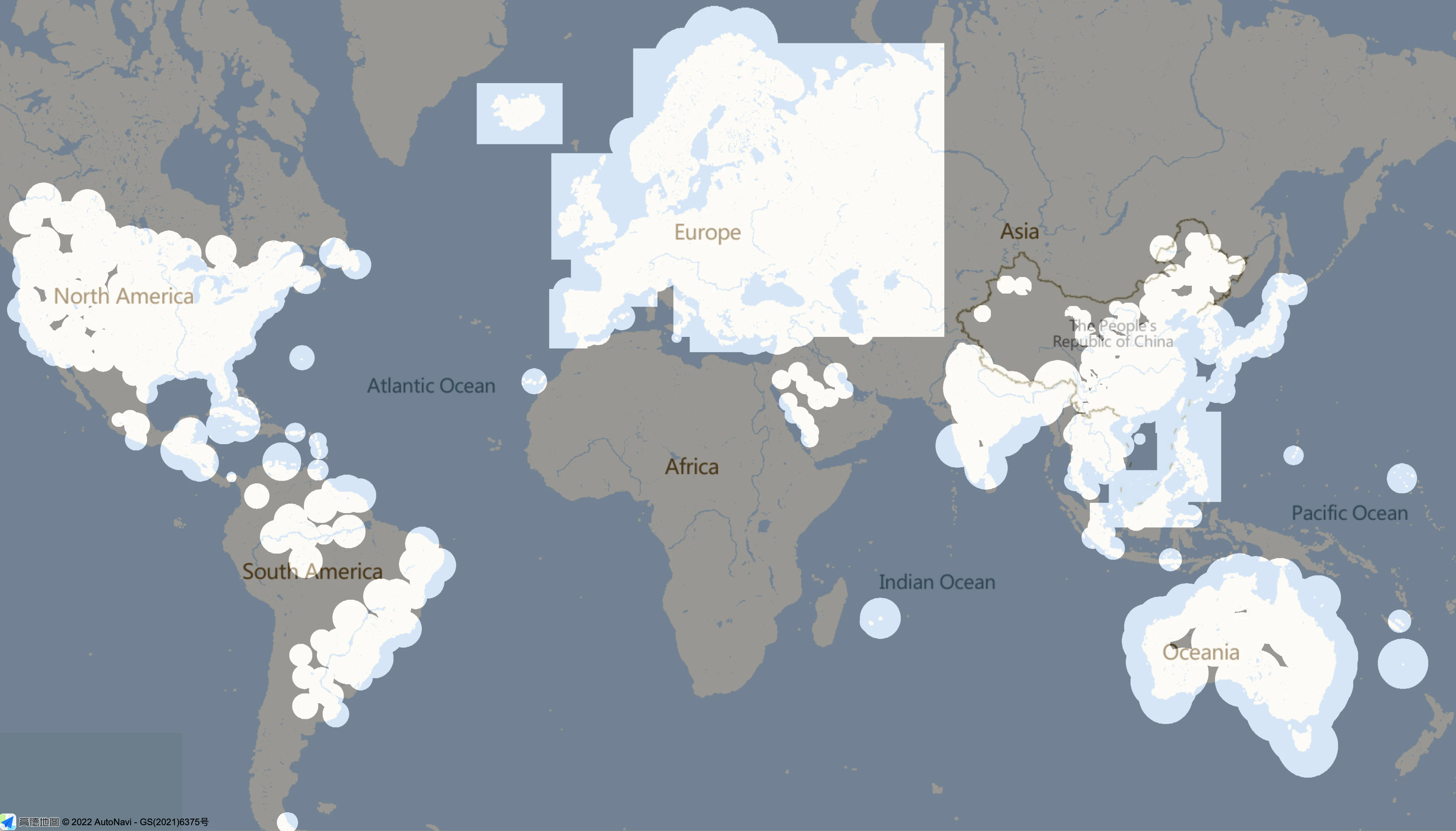
- Minute-level forecasts: Coverage is detailed in the following table and map
| Continent | Countries/Regions |
|---|---|
| Europe | Italy, Lithuania, Malta, France, Slovakia, Norway, Belarus, Iceland, Czech Republic, Slovenia, Germany, Spain, Ukraine, Denmark, Poland, Finland, Sweden, Croatia, Russia, Romania, Portugal, Estonia, Serbia, United Kingdom, Austria, Greece, Hungary |
| Oceania | Australia, Fiji, Guam, Marshall Islands, New Caledonia |
| Asia | China (including Hong Kong, Macao, Taiwan, Diaoyu Islands, Spratly Islands), Turkey, Bahrain, Saudi Arabia, Indonesia, Iran, Singapore, Oman, Philippines, Japan, India, Cambodia, Cyprus, Malaysia, Vietnam, Kuwait, Thailand, South Korea, North Korea |
| North America | Canada, Bahamas, Cayman Islands, Mexico, Panama, Martinique, Cuba, United States, Bermuda, Puerto Rico, Curaçao, Guadeloupe, Nicaragua |
| South America | Brazil, French Guiana, Colombia, Guyana, Paraguay, Argentina |